So a Sudden Stratospheric Warming (SSW) is forecast for November 2025
So what do we look for in the various weather charts out there to follow this events.
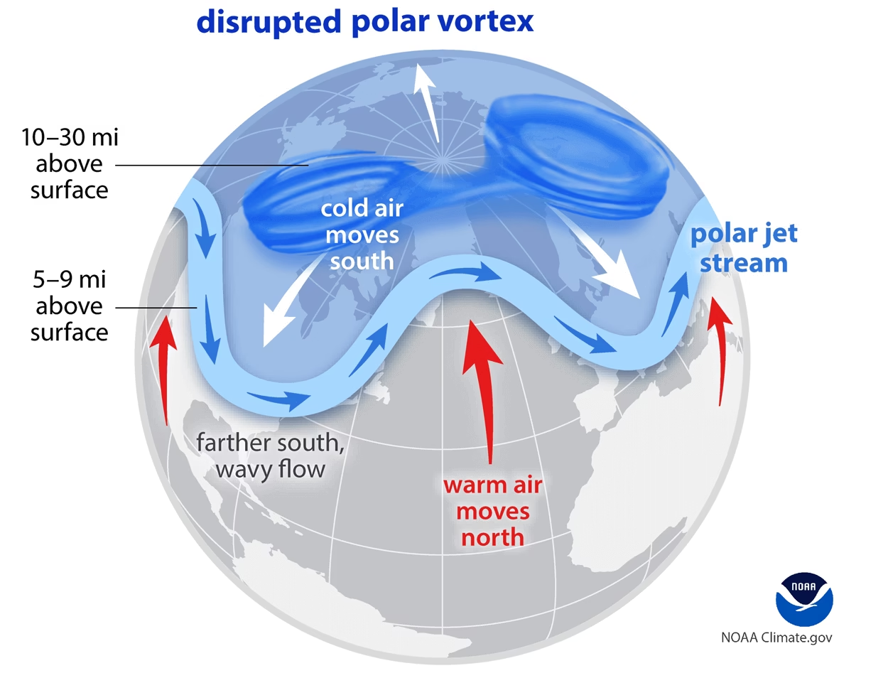
It is very difficult to visualise 3-dimensional fluid flow on the surface of a rotating sphere, and yet meteorological charts and graphics ask us to do just that. We are inclined to think in the dimensions of the flat chart being viewed and our intuition is that Newton’s Laws hold in this space. The atmosphere is not flat, it’s 3-dimensional and it’s being flung around in circular motion, which does weird things to large scale movements. For most amateurs there is probably not much hope in visualising what is going on in a SSW.
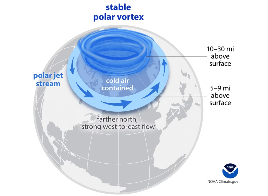
The basic facts and principles behind the general circulation is that the movement of air tries to equalise the temperature difference between the pole and the hotter regions of maximum solar heating at the equator. A mix of warm air moving north and cold air moving south seems inevitable. Normally there is a big swirl of air over the Artic called the Polar Vortex but the interplay of chaotic movement in the circulation can disrupt this normal pattern giving us SSW.

In the Kent and UK area, SSW is linked with cold spells and the reversal of the prevailing westerly winds. For Kent in winter, easterly winds blow out of the cold land mass of Europe and bring unseasonably cold weather. The county’s proximity to the continent doesn’t help and shows that being cold in the UK is not the same thing as being further north. I am working off an assumption that the cold spell comes some 1 to 3 weeks after the SSW is observed. Let’s see.
What to look out for?
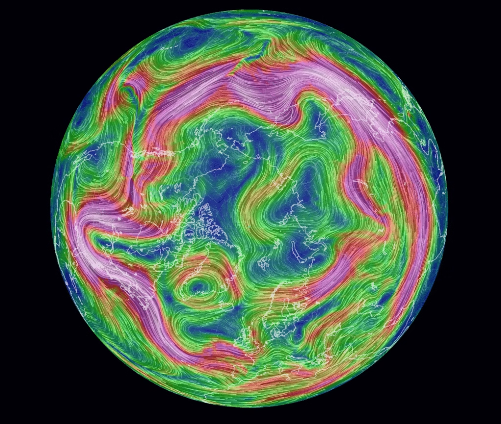
Wind pattern in the Stratosphere at 70 hPa and wind pattern just below the stratosphere at 250 hPa, and see if there are clashing patterns. This is earth.nullschool and the direction of the wind is animated on the link. The winds depicted are for 10 Nov 25. I think there is a stable polar vortex here at the moment.

The European Centre for Medium Range Weather Forecasting have lots of charts but try the following: 10hPa temperature and geopotential.
For more in depth look try the NCEP Sudden Stratospheric Warming page.