Location of Plenty Brook and drainage sewers (blue, light blue), taken from OS 1888-1913, overlayed on Open Street Maps together with OS Zoomstack waterlines (red). Data and sources are reviewed below.

- An analysis of elevation, taken from Environment Agency LiDAR surveys, in central Herne Bay including the Memorial Park area. Elevations below 3.75 m are shaded.

2. Herne Bay on Mudge 1801. This shows a stream heading from Eddington Lane to the coast through the countryside; a significant drainage feature. My georeferencing of this map is not precise enough to deduce an accurate location of the feature.

3. The OS Map series 1888-1913 has the Plenty Brook marked, going under the railway.

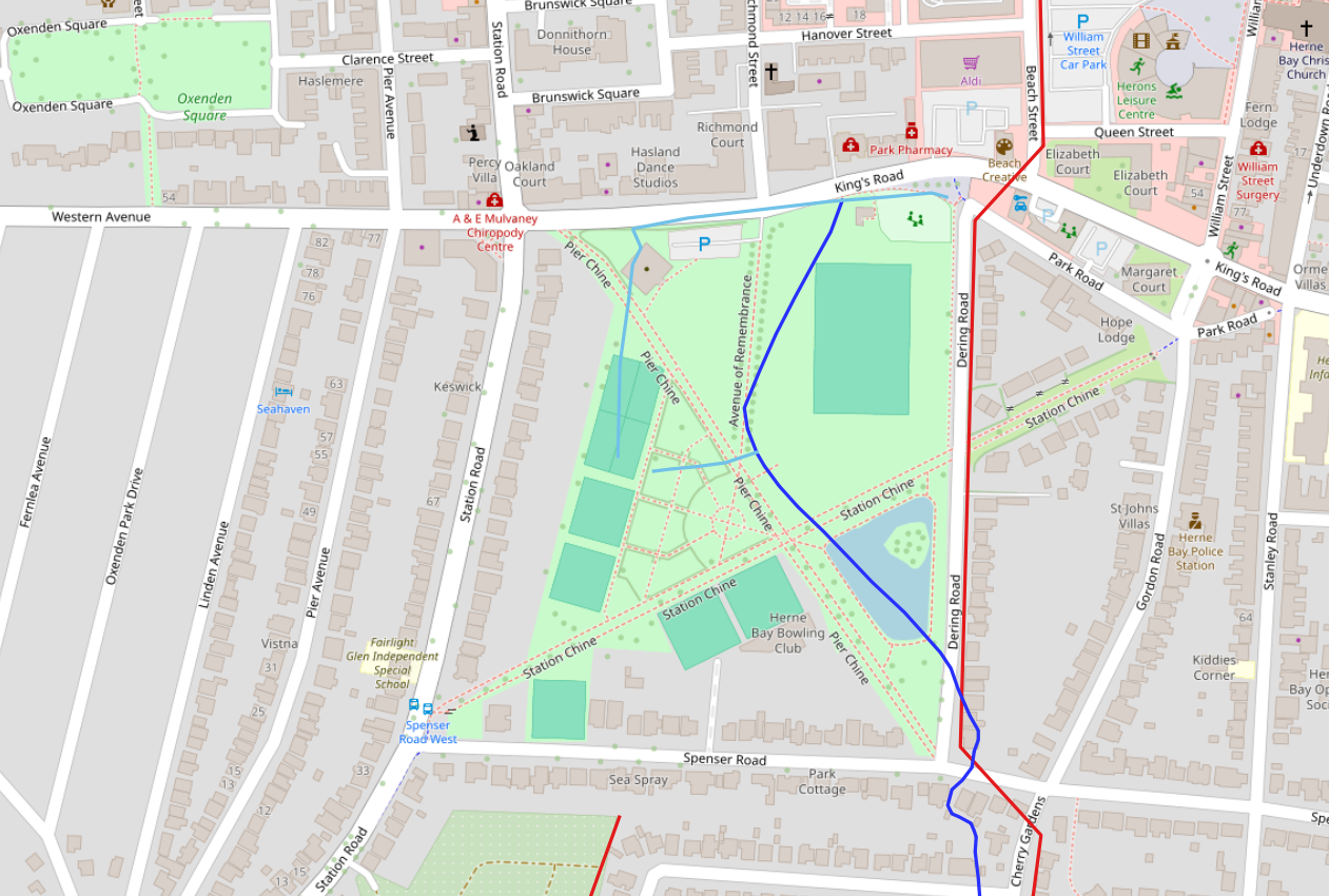
The brook crosses land currently occupied by the Memorial Park and exits the area opposite where the Park Pharmacy is situated today.

4. The OS 1888 map and current OS Zoomstack features can be overlayed as transparency on Google Satellite Imagery.


5. A summary superimposed on Open Street Map.
Aerial photography records an early image of the park in 1932.