Skip to content
Jim Dickson

Jim Dickson

weather, climate, geographic information systems for Kent, UK and global

  • Home
  • About
  • Legal
    • Terms and Conditions
    • Privacy Policy
    • Copyright Notice
    • Disclaimer
  • Contact Form

GIS

Posts involving content processed by Geographical Information Systems.

Long term sea level rise legacy for East Kent

31/10/2025 by Jim Dickson
Open Street Map of East Kent and Thanet flooded up to 2.3 m above OD based on EA LiDAR. Jim Dickson.

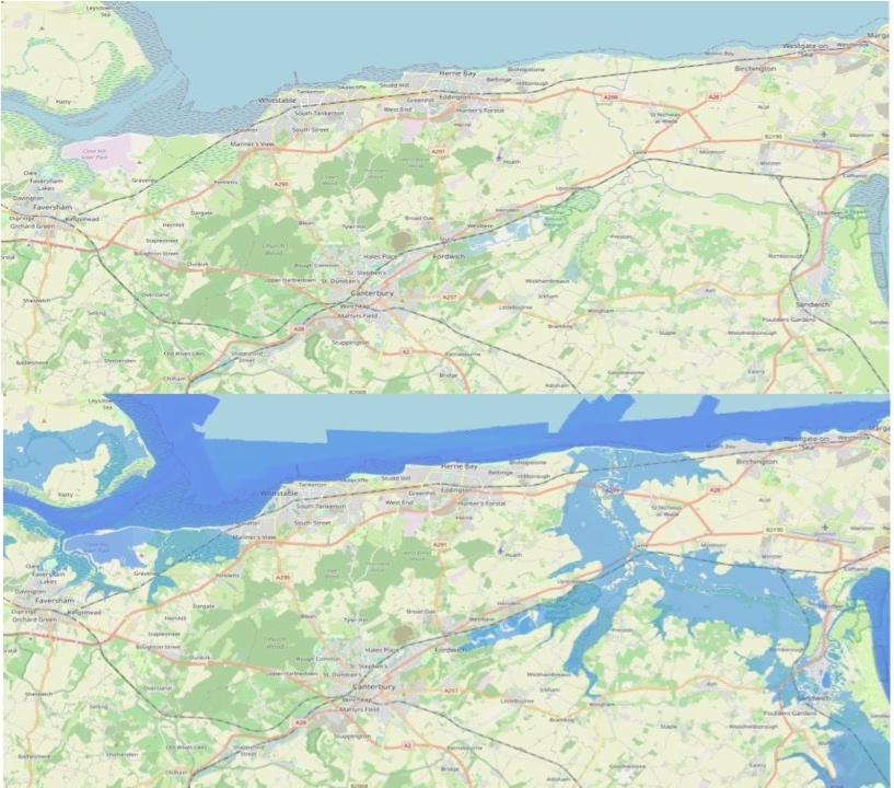
long term sea level rise, locked in by slow changes in oceans and ice sheets, has implications for Kent coastline

Categories Climate, Climate Change Tags GIS, LiDAR, sea level Leave a comment

Saxon Shore Way – Cliffe to Hoo, the Dickens leg.

03/07/202403/07/2024 by Jim Dickson

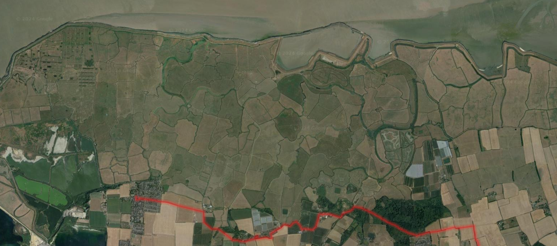
A walking route description, with images and maps, of the Saxon Shore Way between Cliffe and Hoo St Werburgh in Kent, UK.

Categories Saxon Shore Way Tags dog, GIS, public transport, rambling, satellite view Leave a comment

Tracing the Plenty Brook Through Herne Bay

07/07/202415/06/2024 by Jim Dickson

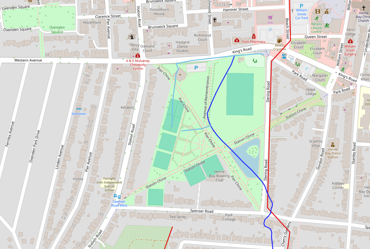
This post presents the historical location of the Plenty Brook as it passed through the Herne Bay Memorial Park area prior to the development of the site.

Categories Historical Landscapes Tags GIS, historical maps Leave a comment

Categories

  • C G Harper drawings – then and now
  • Climate
  • Climate Change
  • General
  • Historical Landscapes
  • out and about
  • Saxon Shore Way
  • Seasonal and Sub-seasonal Weather
  • seen from space
  • sources and resources
  • Weather

Recent Posts

  • Rainbow spotting on north Kent coast, 24 Nov 25
  • Meteorological Teleconnections 14 Nov 25
  • Indoor Temperatures Lag Outdoors in Daily Heating Cycle
  • Sudden Stratospheric Warming Event November 2025
  • Introducing my Meteorological Teleconnections Phase Wheel

Tag Cloud

clouds and weather dog ENSO GIS Herne Bay historical maps historical photographs and drawings LiDAR MJO Mudge NAO OS Open Zoomstack public transport rainbow rambling research papers route flag satellite view sea level seascape sky SSW stuff on the beach Wantsum Channel West Beach Burtie

Meta

  • Log in
  • Entries feed
  • Comments feed
  • WordPress.org
© 2025 Jim Dickson • Built with GeneratePress