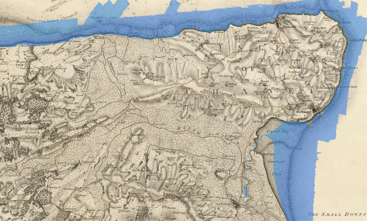
Following my recent post, Searching for Kent’s Wantsum Channel on Historic OS Maps, I wanted to create an animation of a flooding event in the Wantsum Channel. I always find images a useful way of absorbing and communicating knowledge. In this animation by, one can see quickly where the lowest areas of marshland are and where the medieval coastline might have been.
I have created this animated gif using a copy of Mudge’s 1801 map of Kent, courtesy of the David Rumsey Map Collection, which I have georeferenced. The georeferencing used the location of churches, which I thought would be sound. However, the result turns out not to be perfectly accurate.
I have produced the flooding effect by overlaying Environment Agency (EA) LiDAR shaded in steps from a minimum elevation value of 0 m to a maximum value of 2.75 m. In choosing 2.75 I considered how the elevation level related to settlements given on the OS 1888-1913 series of maps. The assumption here was that the location of settlements should be on dry land with the Channel flooded whilst giving decent access to Fordwich by boat.
An image of the Wantsum Channel based on elevations of 2.75 m is as follows. This must show the probable medieval coastline.
