QGIS is an open-source Geographic Information System. I have enjoyed using it to overlay satellite imagery with historical maps. It’s fun to see what was on the landscape in previous ages and how various features have changed. See my posts: Hampton, Herne Bay, Kent. Coastline and littoral then and now. – Jim Dickson and The Naze, Walton – OS Coastline 1888-1913 and Satellite 2024 – Jim Dickson .
When browsing geographic data sources in this way it is not long before you come across LIDAR – Light Detection and Ranging. LIDAR makes it easy to spot various features on the terrain. There is a good set of notes on using LIDAR at the National Library of Scotland.
There is an advantage to bringing all these data layers together in a georeferenced way. Historical maps, satellite imagery and LIDAR can then provide a picture which amounts to more than the sum of its parts.
The enthusiast who does not wish to be parted from much cash in pursuing his or her hobby will have to make do with open-source software. QGIS seems to be the go-to for Geographic Information Systems.
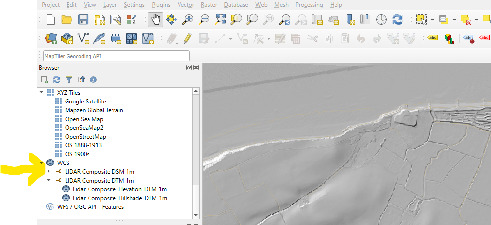
The challenge then is to include LIDAR in QGIS. This turns out to be relatively easy.
I followed Roger Pearse’s blog post on accessing LIDAR data from the Environment Agency.
Roger notes the complexity of all the different data links on offer. He steers his readers away from the WMF/WCS links but these are just what are needed to connect up the data QGIS.
Guided by Roger, I used the link LIDAR Composite Digital Terrain Model (DTM) – 1m (data.gov.uk) . I then copied the WCS link:
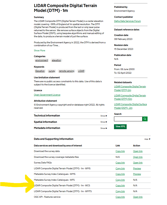
to make a new WCS connection with QGIS. WCS or Web Coverage Service is a connection which suits me here, I only want to pull the data I will look at.