Skip to content
Jim Dickson

Jim Dickson

weather, climate, geographic information systems for Kent, UK and global

  • Home
  • About
  • Legal
    • Terms and Conditions
    • Privacy Policy
    • Copyright Notice
    • Disclaimer
  • Contact Form

satellite view

The Old Lighthouse, East Quay, Whitstable. C G Harper drawing then and now.

07/07/202406/07/2024 by Jim Dickson

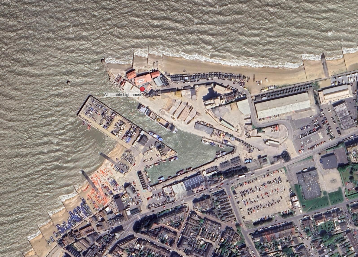
An examination of maps and photographs both current and historical, to find the location of the old Whitstable lighthouse as sketched by C G Harper on his bicycle tours in the 1900s.

Categories C G Harper drawings - then and now Tags historical maps, satellite view

Saxon Shore Way – Cliffe to Hoo, the Dickens leg.

03/07/202403/07/2024 by Jim Dickson

A walking route description, with images and maps, of the Saxon Shore Way between Cliffe and Hoo St Werburgh in Kent, UK.

Categories Saxon Shore Way Tags dog, GIS, public transport, rambling, satellite view Leave a comment

Hampton, Herne Bay, Kent. Coastline and littoral then and now.

27/05/2024 by Jim Dickson

a visual comparison of historic maps and current satellite imagery showing how the coastline at Hampton, Herne Bay Kent has changed.

Categories Historical Landscapes Tags Herne Bay, historical maps, satellite view Leave a comment

The Fractals of Moze Creek and Cunnyfur Ooze

25/05/2024 by Jim Dickson

Satellite image of fractal mudflats in North East Essex.

Categories seen from space Tags satellite view Leave a comment

The Naze, Walton – OS Coastline 1888-1913 and Satellite 2024

27/05/202424/05/2024 by Jim Dickson

Overlay of historic OS map with current satellite imagery to show change in shoreline at Walton-on-Naze.

Categories Historical Landscapes Tags clouds and weather, historical maps, satellite view, seascape, sky Leave a comment

Categories

  • C G Harper drawings – then and now
  • Climate
  • Climate Change
  • General
  • Historical Landscapes
  • out and about
  • Saxon Shore Way
  • Seasonal and Sub-seasonal Weather
  • seen from space
  • sources and resources
  • Weather

Recent Posts

  • Indoor Temperatures Lag Outdoors in Daily Heating Cycle
  • Sudden Stratospheric Warming Event November 2025
  • Introducing my Meteorological Teleconnections Phase Wheel
  • Long term sea level rise legacy for East Kent
  • Ham’s Secret Water – Land Elevation Data and Historical Sea Levels near Eastry Kent

Tag Cloud

clouds and weather dog GIS Herne Bay historical maps historical photographs and drawings LiDAR Mudge OS Open Zoomstack public transport rambling research papers route flag satellite view sea level seascape sky SSW stuff on the beach Wantsum Channel West Beach Burtie

Meta

  • Log in
  • Entries feed
  • Comments feed
  • WordPress.org
© 2025 Jim Dickson • Built with GeneratePress