
Location: ///shadow.than.open, TQ 70722 76802
Satellite imagery provided by Mapbox. https://www.mapbox.com/maps/satellite
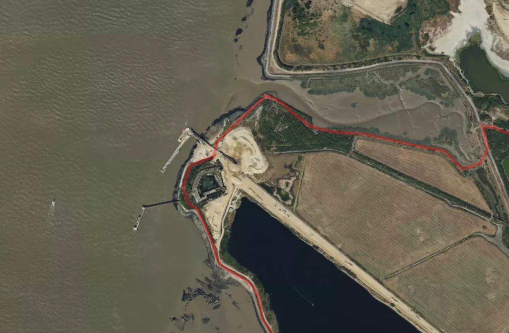
The Saxon Shore Way (SSW) follows a path out of Cliffe and heads to Cliffe Fort. There are gravel works here, with aggregate being unloaded from coastal vessels at a Jetty. There is an awkward albeit safe way through the works for followers of the SSW. It could be an unpleasant surprise if it is unexpected.
Satellite imagery provided by Mapbox. https://www.mapbox.com/maps/satellite
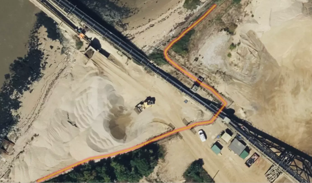
It seems that walkers are kept safe from industrial hazards, but the passage through the works is a little intimidating.
After entering a narrow fenced corridor walkers are taken under a conveyor bearing the aggregate and across a site road. It could be easy to be put off at this point but, when I walked it, it felt well attended by site staff and safe.