
Route and Points of Interest
Download file for GPS- Cliffe Pools Nature Reserve
- Cliffe Fort
- path at Higham Creek
- Higham Saltings
- Shorne Marshes
- industrial outskirts of Gravesend
- Gravesend Town Pier and Tilbury Ferry
Getting There

Whilst our intention was to walk the entire Saxon Shore Way, we were not particular about the order or direction of each segment. Exactly how each section of ground was traversed has been dictated by the availability of public transport. In at least one case, the segments were completed out of order because of a bus driver’s strike. Often it has been found expedient to front load complicated journeys, thus ending with easier ones more suitable for those with tired feet. In this case, we took the train to Chatham Station and then the Number 133/633 Arrivabus to the Six Bells at Cliffe. The return journey was just one train home from Gravesend.
Context
We completed by this walk on a fair September day.
General
A relatively short section alongside the narrowing tidal Thames. The route starts in the marshes of the Hoo Peninsular alongside the Lower Hope and then turns westerly alongside Gravesend Reach. This is not always a picturesque walk, but it is certainly spectacular and full of interest. A walk along the Thames Estuary brings ramblers face to face with history and confronts them with the scars of a wartime and industrial past.
Points of Interest
Cliffe Pools Nature Reserve. view on map Paths good. Lots of birds. A view back to Cliffe reveals the inspiration for its name, with a small but emphatic cliff at the edge of Allen’s Hill. It is this sort of feature which is quite striking about the Saxon Shore Way. In days gone by this cliff was the estuary shore. In the modern era, the shoreline is now a mile or so away out at the fort. The Saxon Shore Way does not always follow the modern shore.
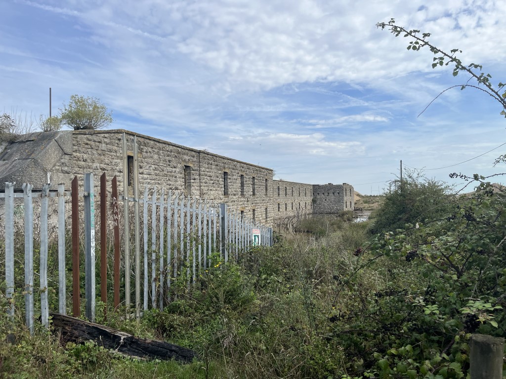
Cliffe Fort. view on map disused and ghostly; Wikipedia entry. Gravel or construction works restricted the path in this area, but proper safety protocols seemed to be observed. Not necessarily the nicest place to walk, but interesting to see.
Path at Higham Creek. view on map The path follows a narrow section of dry land with a flooded gravel pit on one side and tidal mud flats on the other. The narrow access from the fort was crowded by grazing ponies. These creatures, unkempt in appearance, had a slightly wild look in their eyes which was intimidating. There was no going back for us and we passed through them in close formation with the dog.

Higham Saltings view on map. Here, the shore borders deep water and the cruise liners pass so close that you can hear the clink of cocktail glasses across the water. The currents and winds collect plastic rubbish which is left littering the high tide line.
Shorne Marshes and the approach to Gravesend. view on map After some mild adventures the way becomes easier and more pleasant. Another fort, Shornmead Fort, once defended the Gravesend Reach here. The marshes extend inland some distance and appear to be in use as firing ranges and there is no access inland. Thus, the way is relatively lonely with just the occasional off-road cyclist or dog walker of a more energetic disposition. Closer to Gravesend, the remains of a Merchant Naval college is apparent complete with facilities for training sea survival, which look still usable.
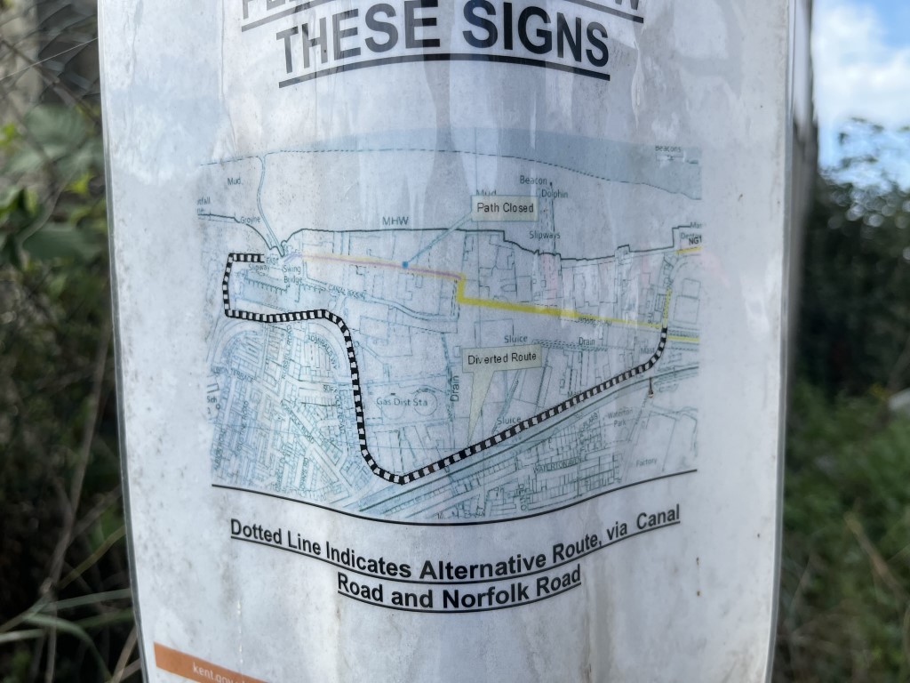
The Industrial Outskirts of Gravesend. view on map Our entry into Gravesend was hampered by a path closure through an industrial estate. Nearer into town there were berths for houseboats and the whole waterfront became attractive and brighter.
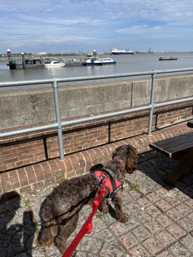
Gravesend Town Pier and Tilbury Ferry view on map The end of our walk and the beginning of the Saxon Shore Way. The ferry provides access from Kent to East Anglian adventures.