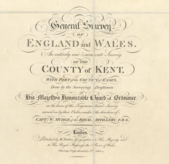
A truly great starting point for precise exploration of Kent. Earlier maps exist, but this is a sophisticated survey. Available from the David Rumsey Map Collection, as embedded above, it can be downloaded and georeferenced in QGIS where it can be studied alongside newer maps, satellite images and LiDAR.