- 1. Bus stop at Six Bells, Cliffe
- 2. St James's Church and Pip's Graves
- 3. View point Northward Hill
- 4. Difficult access to path at Fenn Street petrol station
- 5. This walk leaves the Saxon Shore Way
- 6. Bus stop at Five Bells, Hoo St W
“…that the dark flat wilderness beyond the churchyard, intersected with dykes and mounds and gates, with scattered cattle feeding on it, was the marshes; and that the low leaden line beyond, was the river; and that the distant savage lair from which the wind was rushing, was the sea.” Great Expectations, Charles Dickens

Context. This route was the second stage in our walking of the Saxon Shore Way following our walk from Cliffe to Gravesend. The Saxon Shore Way walks are collected on the summary page Saxon Shore Way We walked this route in September 2022. A partly cloudy and dry day gave temperatures around 13 oC giving comfortable walking conditions.
Getting there and back on Public Transport. Following our intention of walking the Saxon Shore Way using public transport, we took the train to Chatham and then caught the number 133 bus to the Six Bells bus stop in Cliffe view on map. We returned on the 191 bus from the Five Bells, Hoo St Werburgh view on map which took us back to Chatham railway station and our return journey home. Access to this return bus needed a bit of a route march away from the Saxon Shore Way into the centre of Hoo St Werburgh.


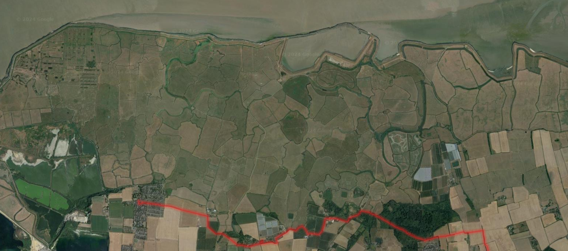
General. Access by public transport involving two journeys, both with bus and train rides, meant that this was a shortish walk for us. This is an atmospheric part of the country and the extensive marshland of the Thames Estuary on the Kent shore is very striking; who would believe that such a lonely wilderness existed within striking distance of one of the World’s great cities. The Saxon Shore Way follows the boundary between ancient cultivated land and the marsh and, with the exception described below, is well-marked and easy to follow.

Cooling. Cooling with its association with Charles Dickens’s Great Expectations is probably the most memorable site on this walk.

Pip’s Graves. The walk is haunted by the spirit of Charles Dickens the opening of whose book, Great Expectations, was inspired by the marshes and the churchyard of St James at Cooling view on map. The graves are a moving sight.
“To five little stone lozenges, each about a foot and a half long, which were arranged in a neat row beside their grave, and were sacred to the memory of five little brothers of mine — who gave up trying to get a living, exceedingly early in that universal struggle — I am indebted for a belief I religiously entertained that they had all been born on their backs with their hands in their trousers—pockets, and had never taken them out in this state of existence.” Quote from Chapter 1, Great Expectations, Charles Dickens, in the voice of Pip.
The children’s graves here date from between 1771 and 1790. They all died before the age of 17 months and are buried around the grave of their parents Michael and Jane Comport. The three graves on the far side of the gravestone belong to the children of John Rose-Baker and Sarah Anne, daughter of Michael Comport. They died aged one, three and five months in the mid-19th century. It is all painfully sad. It is also remarkable to note that Malaria was once common in the marshes of the Thames Estuary. Life has been difficult on these marshes.

The path around High Halstow. The way skirts around the village of High Halstow. To the north, it borders the RSPB Northward Hill Nature Reserve. There is a viewpoint view on map which offers excellent vistas across the marshes and beyond.


Difficult Access to Path at Fenn Street petrol station. The path crosses the edge of a petrol station forecourt of a petrol station at Fenn Street and continues up the side of the associated building. At the time we walked it, it was very overgrown with vegetation. The going was so difficult I had to carry the dog above the tangle of stems and burrs view on map.

Towards the Medway. After Fenn Street, the way heads across well-tended farmland towards the Medway Estuary and the next stage of the Saxon Shore Way story.
